New Zealand’s Rugged East Cape | Tolaga Bay to Hicks Bay
When travelling through New Zealand with a dear Kiwi friend, there’s always a certain kind of magic woven into the days. The road seems to open a little wider, conversations wander easily between past and present, and moments appear that feel both ordinary and quietly unforgettable. Before continuing further north, I invite you to revisit the earlier chapters of our journey from Auckland travelling north to the East Cape, [here] before returning to Auckland where coastal roads, vineyard landscapes, and places layered with history and natural beauty await us.
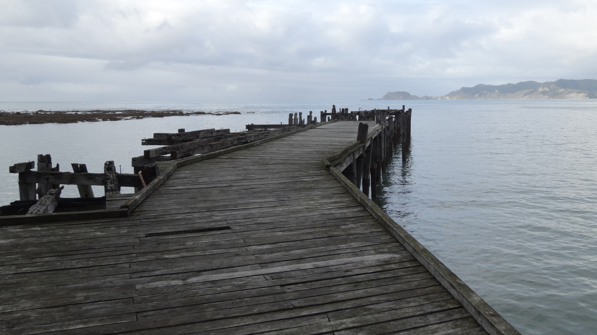
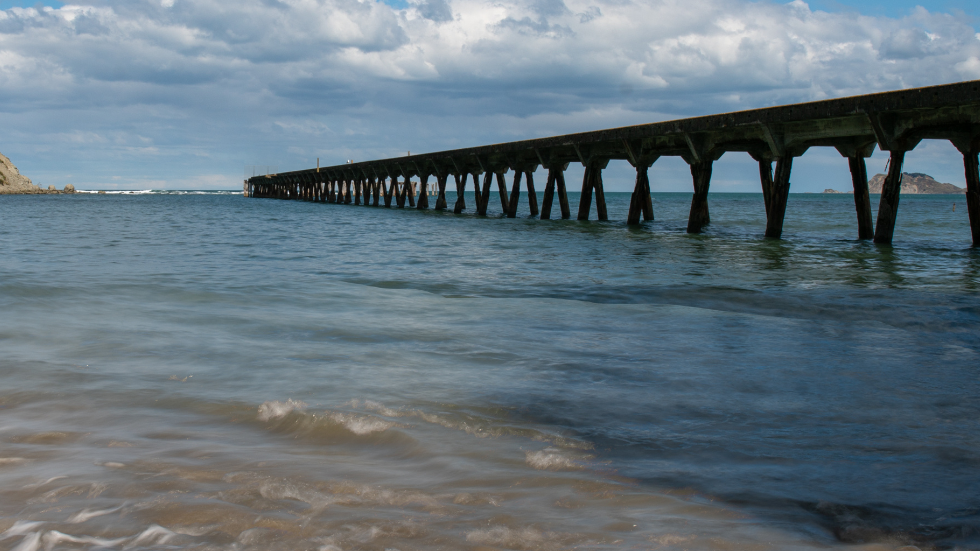
Leaving the charm of Gisborne, we followed State Highway 35, the main coastal road tracing the eastern edge of the North Island, travelling approximately 33 kilometres to Tolaga Bay Wharf.
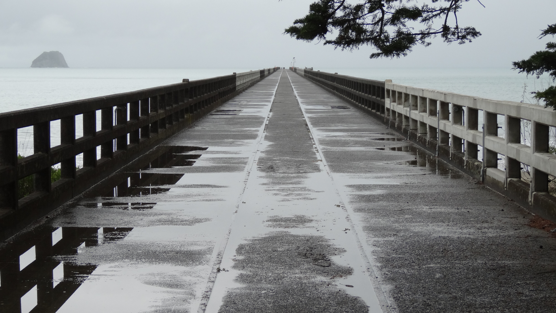
Stretching 600 metres into the Pacific Ocean, Tolaga Bay Wharf is New Zealand’s longest wharf and a striking feat of early 20th century engineering. Plans for the structure emerged in the early 1920s, driven by the need to overcome the region’s isolation, and construction began in 1926. When it officially opened in 1929, the wharf replaced earlier 19th century landing structures and transformed Tolaga Bay into a vital coastal port.
For several decades, it served as a crucial loading point for wool, livestock, timber, maize, dairy produce, and general agricultural goods, linking East Coast farming communities with larger ports and international markets. Supplies such as fertiliser, fuel, and machinery also arrived here, sustaining life and industry along this remote coastline. Although commercial shipping ceased by the late 1960s as road transport improved, the wharf still carries a physical sense of movement, of tides, and time passing, made all the more poignant by the expansive views across the bay and the rolling hills beyond.
Although no longer a working port, Tolaga Bay Wharf remains a beloved historic landmark.
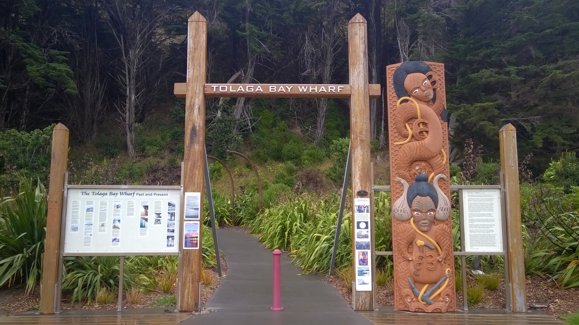
It’s an overcast and drizzly day, and before stepping out onto the wharf itself, we arrived at a carved Māori pou and accompanying information panel, offering context and grounding the place in its deeper history. The carving features two interwoven faces, rich with traditional whakairo patterns. Rather than decoration alone, the figures speak of whakapapa (genealogy), connection, and guardianship, anchoring the wharf within its Māori cultural landscape.
The figures appear bound together, not in conflict, but in relationship, suggesting continuity between generations, land and sea, past and present. Standing beside it, there’s a quiet reminder that long before cargo and concrete, this coastline held meaning, memory, and story.
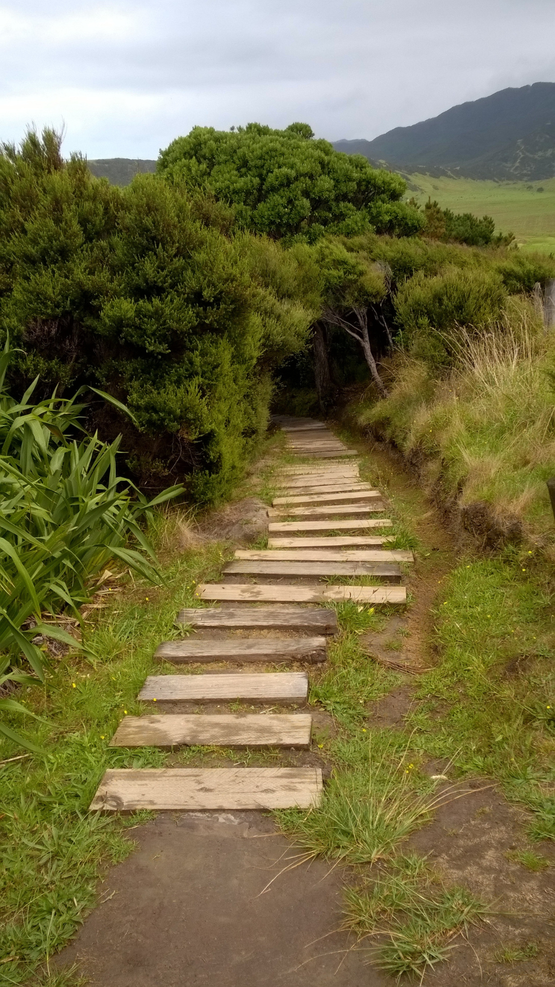
From Tolaga Bay Wharf, it’s a short drive along State Highway 35 to Anaura Bay, about 13 kilometres north. The coastal road curves with the land, before opening up to s stretch of long sandy shores and ocean views that ask you to slow down and look.
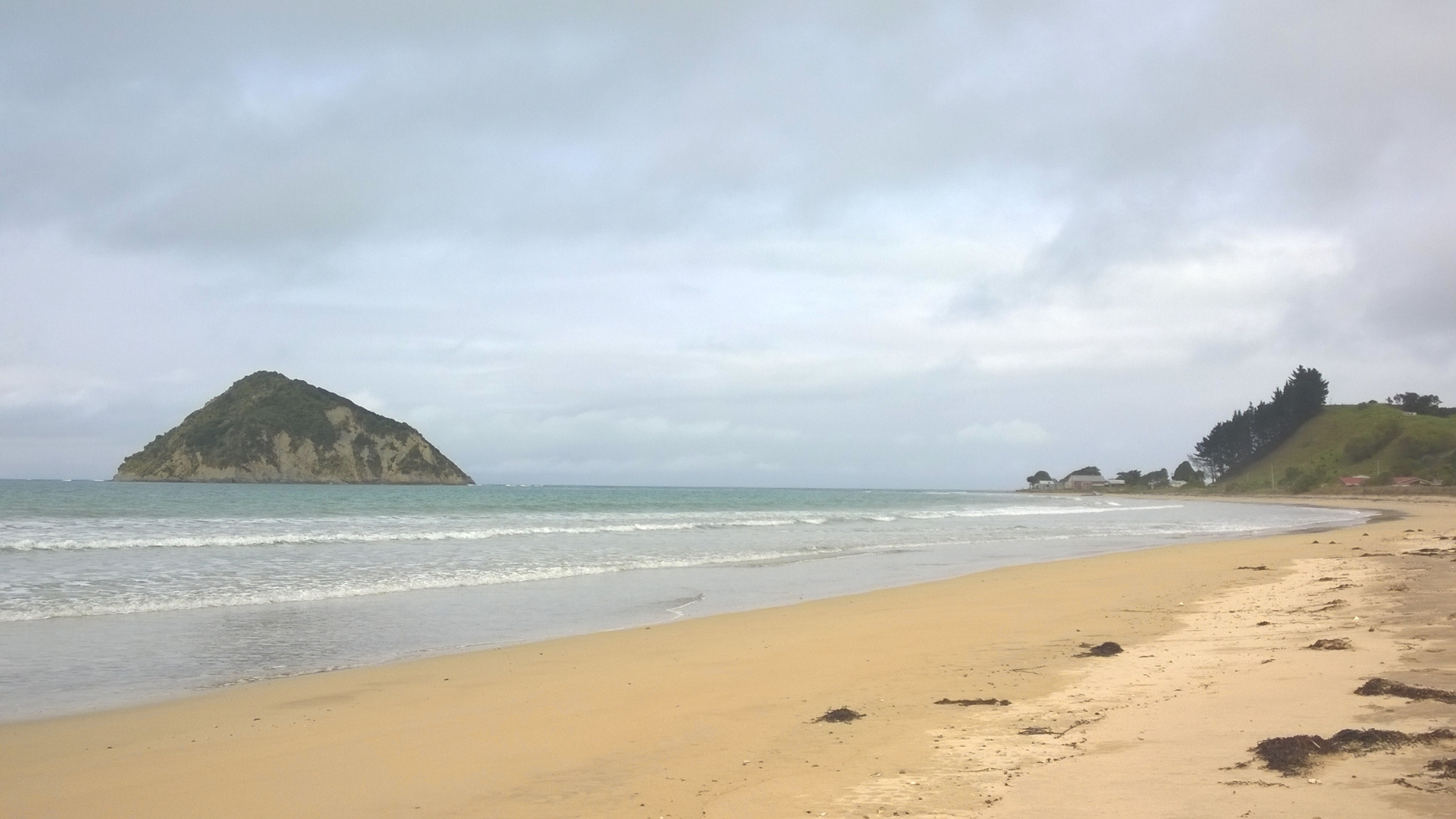
Arriving at Anaura Bay, we’re greeted by a 2 kilometre beach of golden sand backed by low hills and watched over by two small islands just off the coast, known as Motuoroi and Motuhina, watching over the bay.
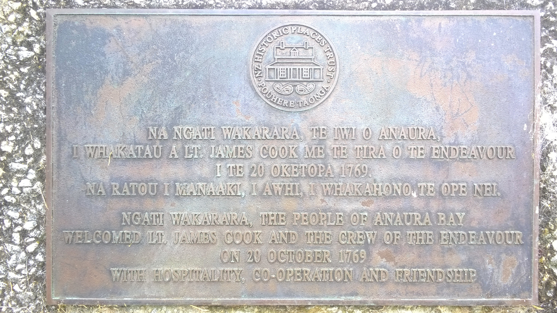
This beach has long been more than a pretty stretch of sand. In 20 October 1769, British explorer Captain James Cook and the crew of Endeavour sailed into Anaura Bay and were welcomed by local Māori in their canoes. A memorial plaque written in both Māori and English, commemorates this historical landing. On shore, Cook recorded in detail the orderly and extensive kūmara gardens and other horticulture that flourished here, and is one of the earliest written descriptions of Māori cultivation in New Zealand.
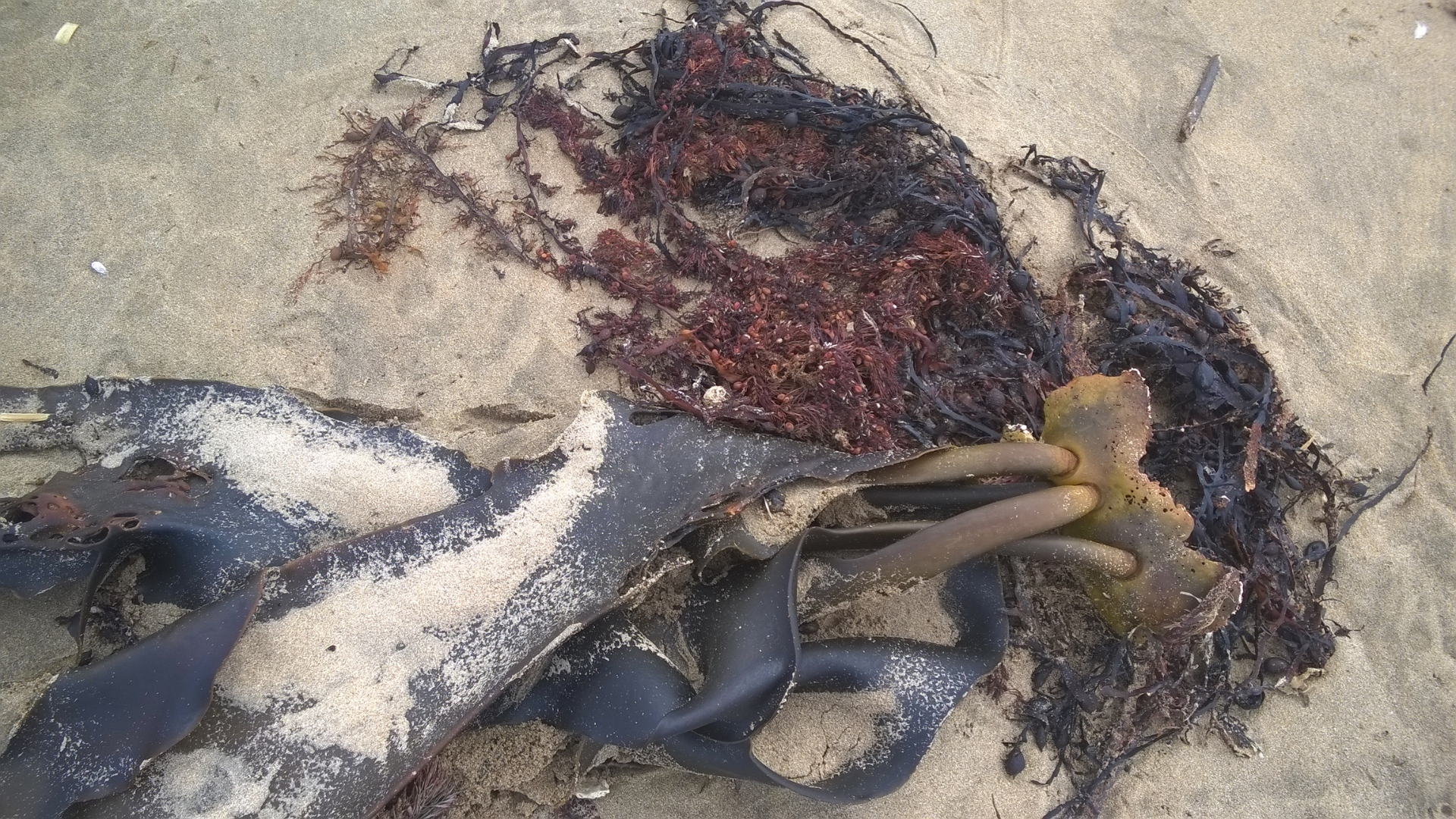
During low tide along the long sandy shore, you’ll likely spot patches of seaweed and algae washed in with the swell These form part of the rich coastal ecosystem, including red and brown algae species common along exposed New Zealand shores. Species like Pterocladia lucida (rimurimu), a native red algae traditionally used and later forming part of New Zealand’s agar industry, can be found on rocks, in shallow water, and scattered on the sand reflecting the lively biology of these coastal waters.
The bay was once the domain of sizeable gardens and villages, and even in the late 19th and early 20th centuries was part of large sheep stations worked by British settlers. Remnants of this more recent history, including old wool machinery can be found near the beach.
Today, Anaura Bay is a relaxed bay and open place, shaped by people, sea and seaweed, with its history held within the landscape.
Leaving Anaura Bay behind, our journey continued north along State Highway 35 toward Tokomaru Bay, a small coastal township of fewer than 500 people, with a long story tied to the sea and a historic industry. Known in years past as Toka-a-Namu, a name referencing to the abundance of sandflies in the area, before evolving into Tokomaru Bay.
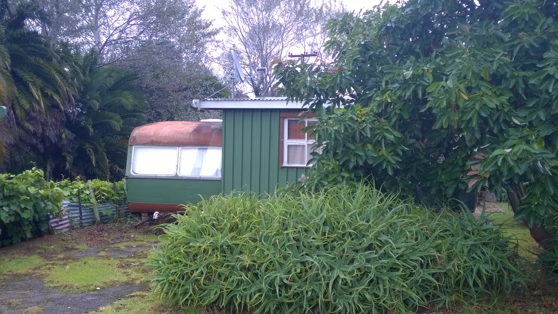
Just before reaching the township, you’ll find what locals call “The Ruins”, a quirky, makeshift kind of stopover that has become part of the East Cape Road trip experience.
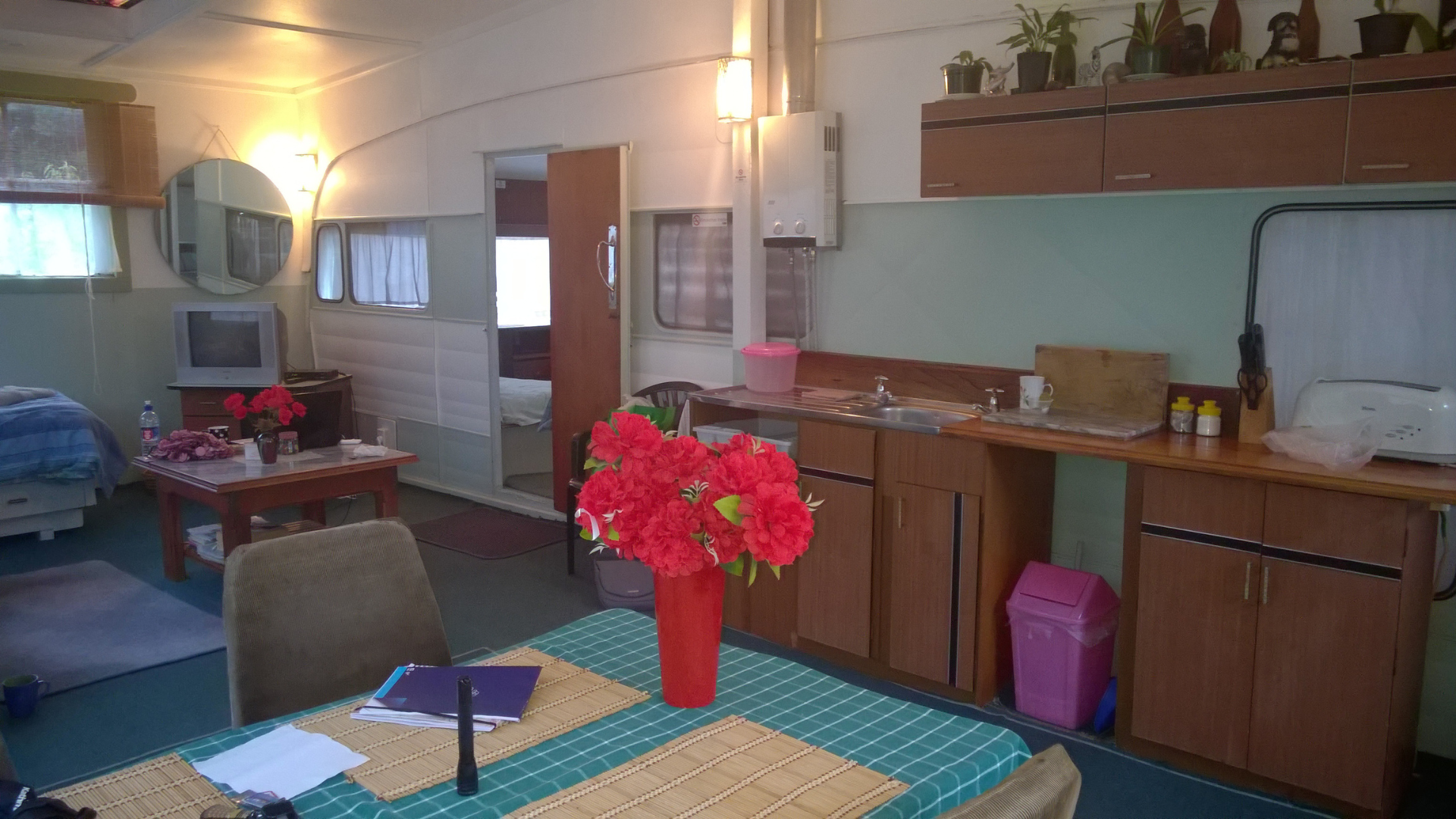
Staying at The Ruins was part adventure, and part time travel. Two old caravans repurposed as rustic and very memorable style cabins sat among an overgrown site with crumbling remains of the former Tokomaru Bay freezing works, abandoned since the 1950's.
With atmosphere in abundance and WIFI that came and went as it pleased, it felt almost appropriate, this stretch of coast still answers more to land and sea than to signal bars. This is not a polished holiday park with manicured lawns; it’s more like a time capsule. Staying here was like camping inside history: with resonances of hard yakka, early 20th century optimism, and the slow reclaiming power of nature. For photographers, history lovers and those with a taste for the unconventional, The Ruins has an unmistakable unique charm.
The area surrounding The Ruins has long been shaped by both industry and the sea. In the 1840s, Tokomaru Bay was a major port for coastal shipping and shore whaling, laying the foundations for its later role in pastoral exports.
As roads were still rudimentary, wool bales, meat and other agricultural goods were regularly shipped out by sea while supplies and general merchandise arrived aboard coastal vessels, underlining the community’s connection with maritime trade.
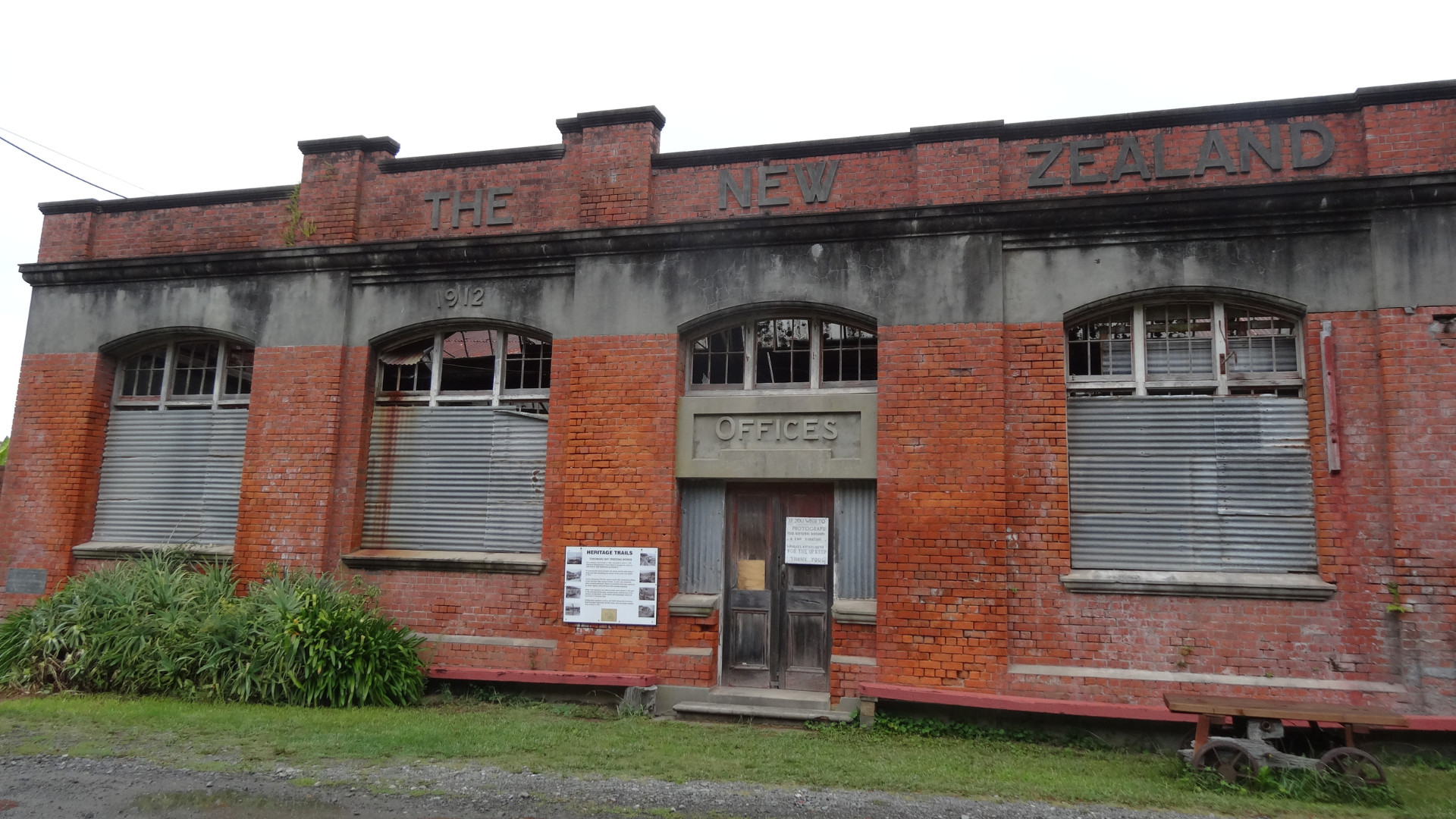
By 1911, optimism and growth along the East Coast saw local farmers fund the establishment of the Tokomaru Bay Freezing Works, enabling sheep and cattle to be processed nearby rather than driven long distances inland.
Built alongside this industrial surge, the Tokomaru Bay wharf was constructed around the same time to service the works and was extended in the early 20th century. During its busiest years, Tokomaru Bay became a busy port, handling hundreds of vessels annually, exporting frozen meat and bringing in supplies. The freezing works provided employment and helped secure the town’s economy for decades. However, as road transport improved and coastal shipping declined, the economics shifted. By the early 1950s the freezing works had closed, and coastal freight services ceased by the 1960s.
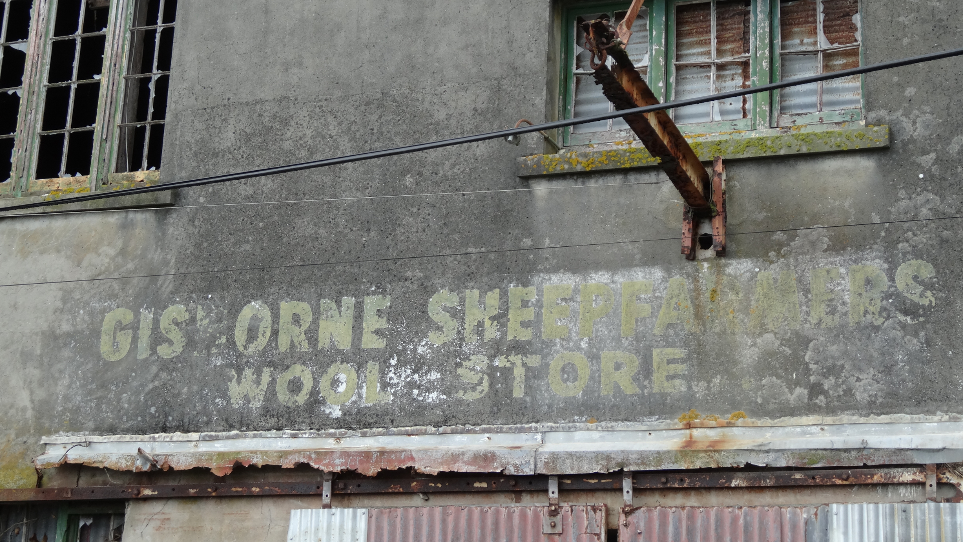
Today, relics of that past, from the old wharf to the crumbling remains of the freezing works and wool store, are visible along the bay’s northern end, offering a stark contrast between what the township once was and showing how quickly industry can arrive, flourish, and fade, into the quiet community, it is now.
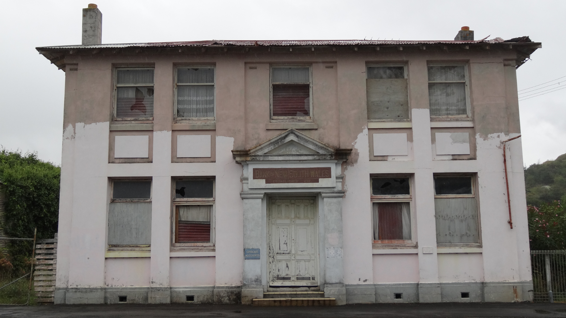
Even the remnants of the town’s bank, the Bank of New South Wales, established in Sydney, Australia in 1817 under a charter signed by Governor Lachlan Macquarie, and among the earliest banks to open branches throughout Australia and New Zealand, speak to the reach of early colonial commerce. The Bank of New South Wales later became part of Westpac Banking Corporation, one of Australia’s major banking institutions with more than two centuries of continuous history.
Standing on the beach with the old wharf nearby and the remnants of industry just out of view, it’s easy to sense the layers here: a Māori settlement shaped by whenua, meaning the land as a source of identity and connection and the sea, a coastal port driven by early 20th century ambition, and a present day community that carries these stories.
When it was time to leave Tokomaru Bay the following day, the road along State Highway 35 naturally continued toward the town of Tikitiki, a leisurely one hour’s drive, weaving through coastal curves and hills.
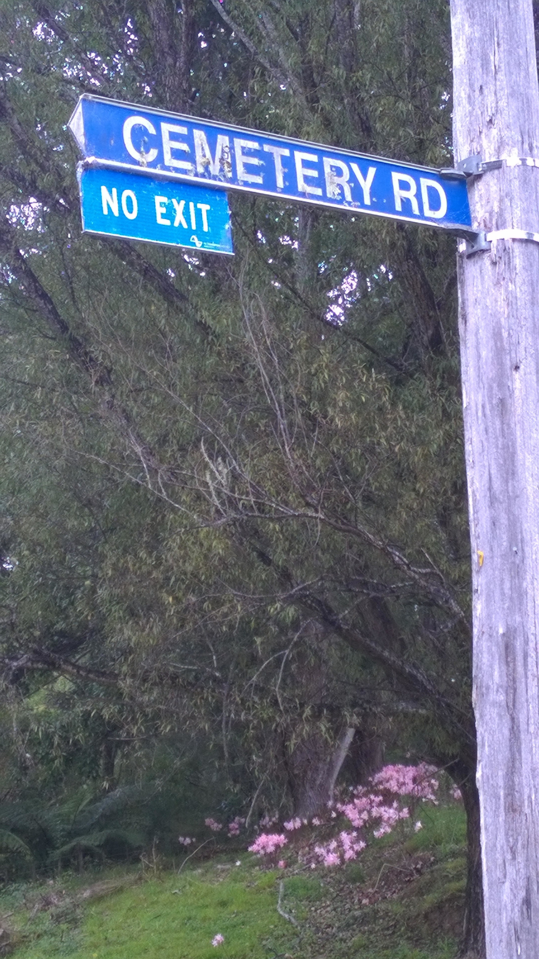
An interesting road sign moment en route, to Tikitiki ‘Cemetery Road’ with a smaller ‘No Exit’ sign below.
Tikitiki may not be a large place, but it holds cultural and historical significance for the Ngāti Porou people and for the wider East Cape. The towns name comes from Māui-tikitiki-a-Taranga, referring to the legendary Māori demigod Māui and linking the place to the rich tapestry of Māori cosmology and story.
Just on the outskirts above the town on a hilltop sits St Mary’s Church, often called Tikitiki’s jewel. Built between 1924-26, and consecrated on 16 February 1926 as both a war memorial to Ngāti Porou soldiers who fought and died in the First World War and a celebration of Christianity on the East Cape.
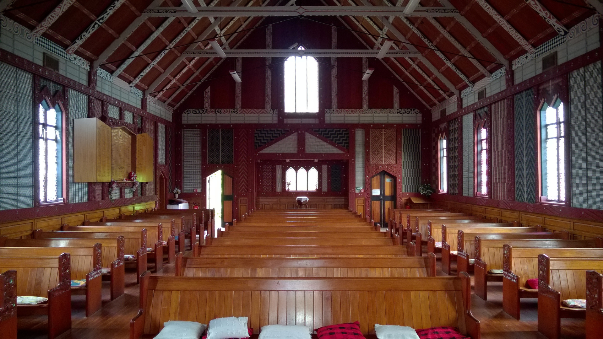
The exterior’s Gothic Revival form gives way to an interior rich with Māori carvings, tukutuku (woven panels), kōwhaiwhai designs, and stained glass, creating a amazing blend of artistic traditions. Much of the carving work was done by local tohunga whakairo (master carvers), and the weaving overseen by community weavers, as part of a broader undertaking to revive and sustain Māori arts and crafts.
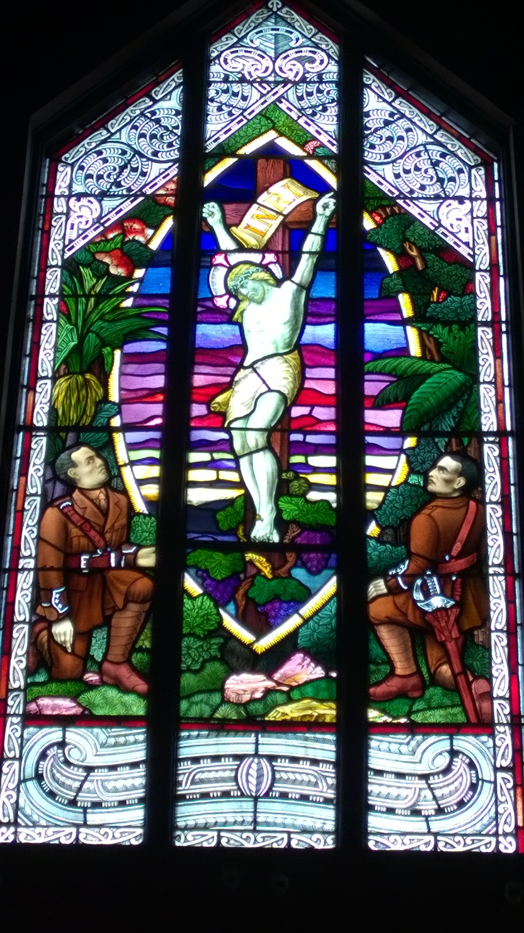
One of the most striking features is the stained glass depiction of Second Lieutenant Henare Kohere and Captain Pekama Kaa kneeling at Christ’s feet, both Ngāti Porou men who lost their lives in the Great War, a poignant tribute within a building already layered with cultural meaning.
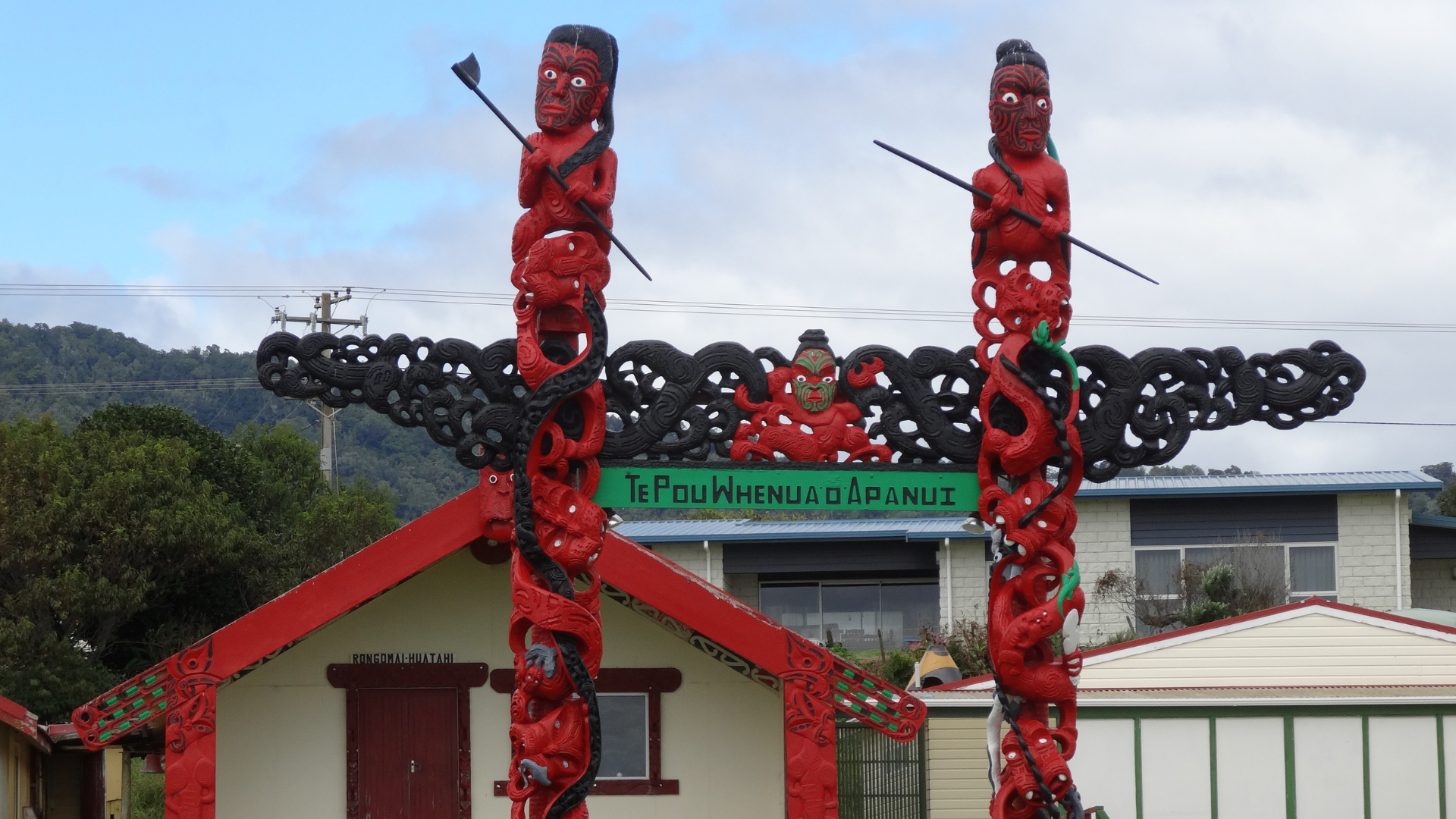
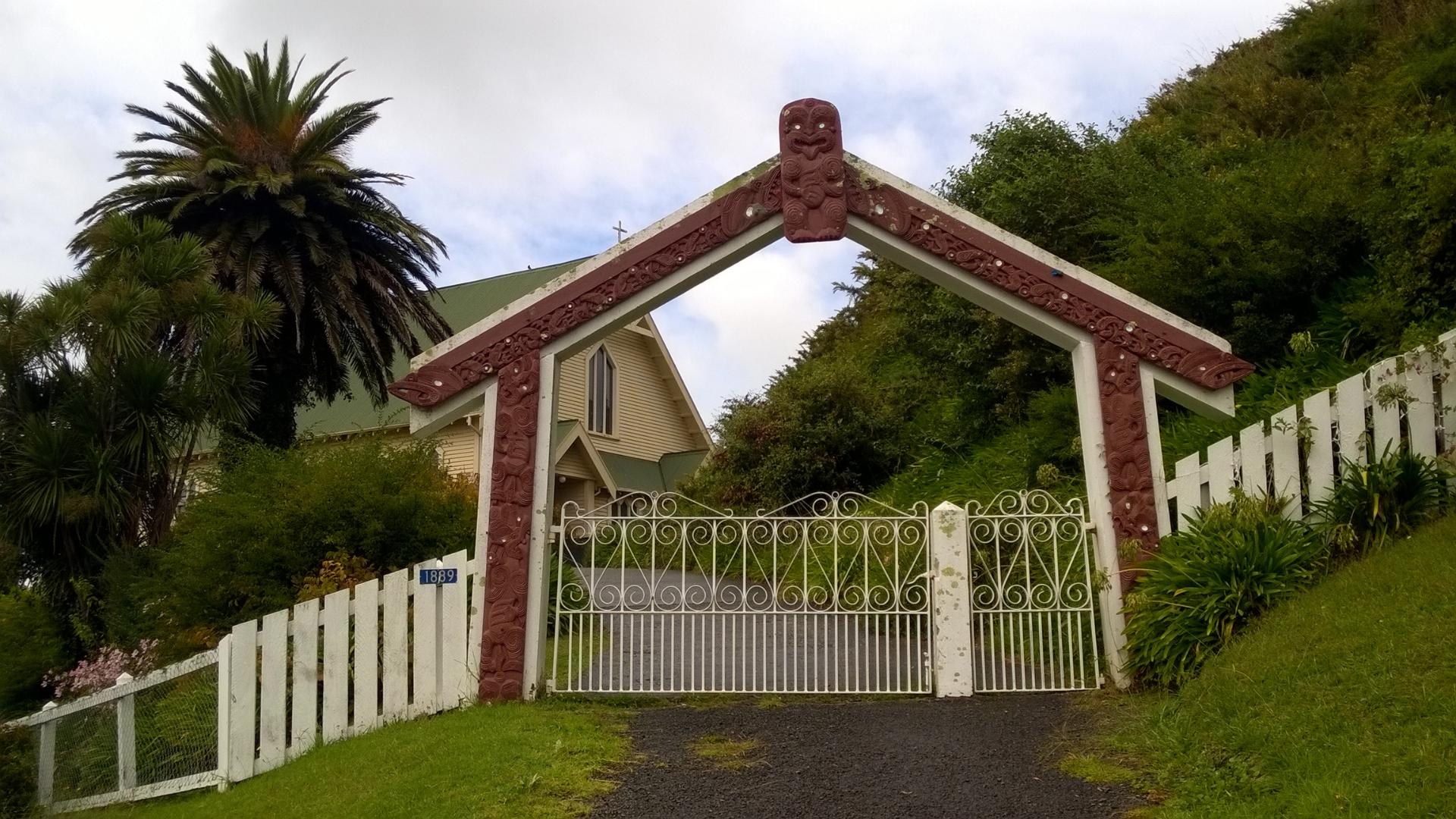
Not far from St Mary’s Church stands the carved gateway of Te Pou Whenua o Apanui. The pou, in Māori meaning a post or pillar, are not ornamental, but act as protectors, affirming Ngāti Porou presence, identity, and continuity within the valley. Whenua speaks to land, and o Apanui to whakapapa and ancestral connection, together illustrating that education, culture, and place are inseparable here.
After the industrial remnants of Tokomaru Bay, the small coastal town of Tikitiki marks a gentle but unmistakable shift: from industry to artistry, from commerce to spirit, where land, learning, and lineage continue to stand firmly together, and creativity are woven into every carving and tukutuku panel.
From Tikitiki we continued onward toward the small town of Te Araroa and the most easterly point on the North Island; East Cape Lighthouse and Trigg Station, weaving in more distances, and scenic drives that make this part of the world so unforgettable.
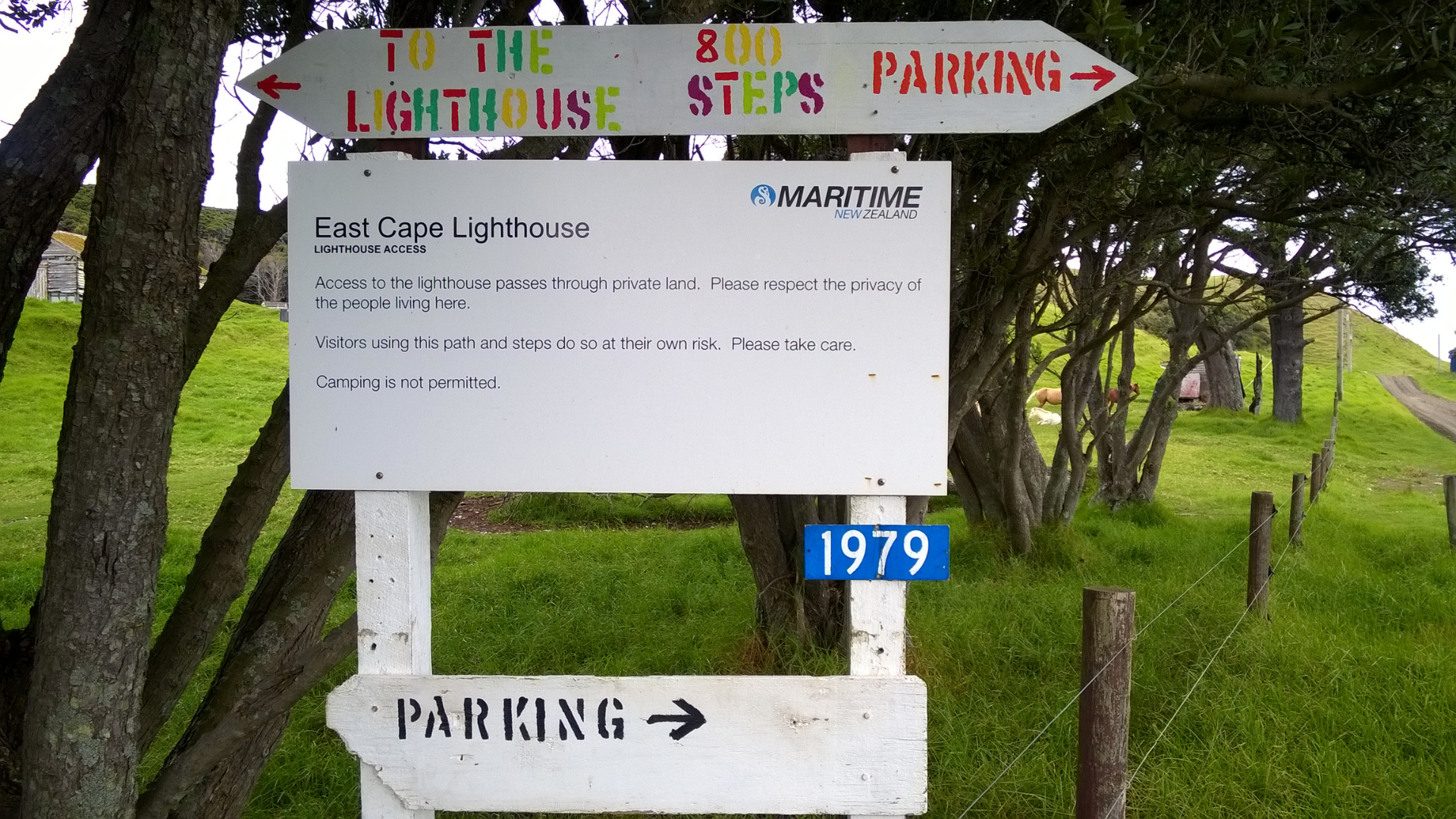
Parking the car near the signage for East Cape Lighthouse, there’s a quiet sense of arrival at a place where land meets sea in a way that seems to stretch time itself.
The air is crisp, and beneath misty skies we begin the walk up the 800 steps that lead to the headland.
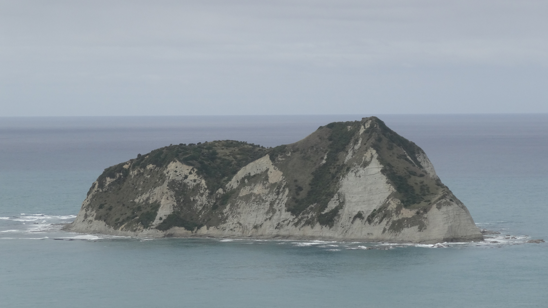
From the edge, the views across the Pacific Ocean stretch out to the horizon, with one small rocky islet nearby; that is locally often simply referred to as the East Cape rock stack, standing against the constant swell.
As we catch our breath from the climb and take it all in, the coastline expands southward in broad, rugged curves of lush green and rugged cliffs that don’t have a single official name, but everywhere you look offers moments to simply be, and appreciate the natural beauty.
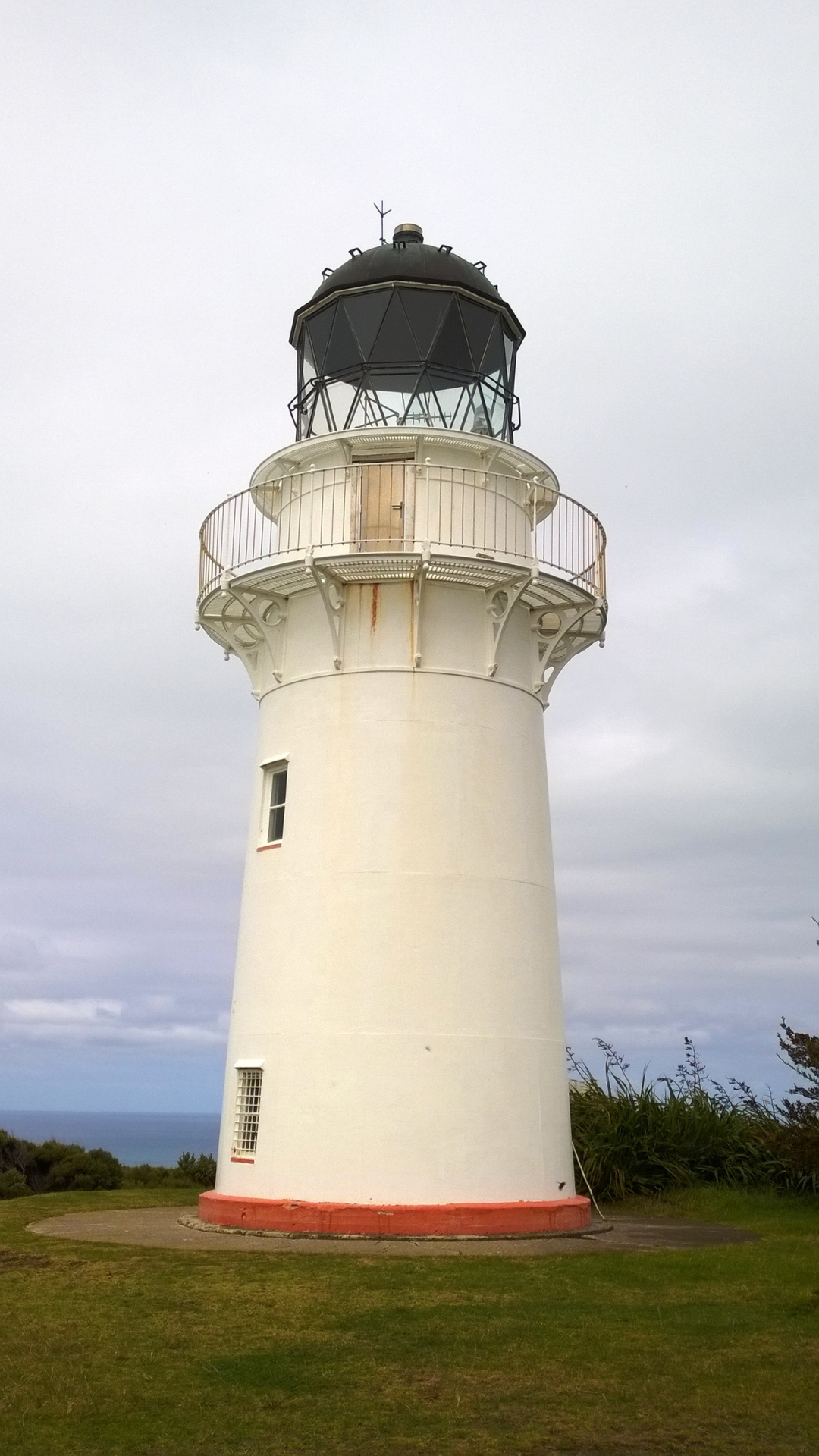
The East Cape Lighthouse was first lit in 1900, built to guide coastal shipping along these remote stretches of the Pacific coastline and to mark the far reaches of the North Island. Originally manned, the station included Trigg Station, a nearby support base for lighthouse keepers and their families, where homes and community spaces tied human life closely to this extraordinary landscape.
Life at the station changed dramatically when the lighthouse was fully automated in 1985, and the need for resident keepers disappeared. Today, the light continues to operate, monitored remotely by Maritime New Zealand, while the remnants of Trigg Station have mostly returned to the land, signifying an era of resilience and dedication by those who lived and worked at the edge of the island nation.
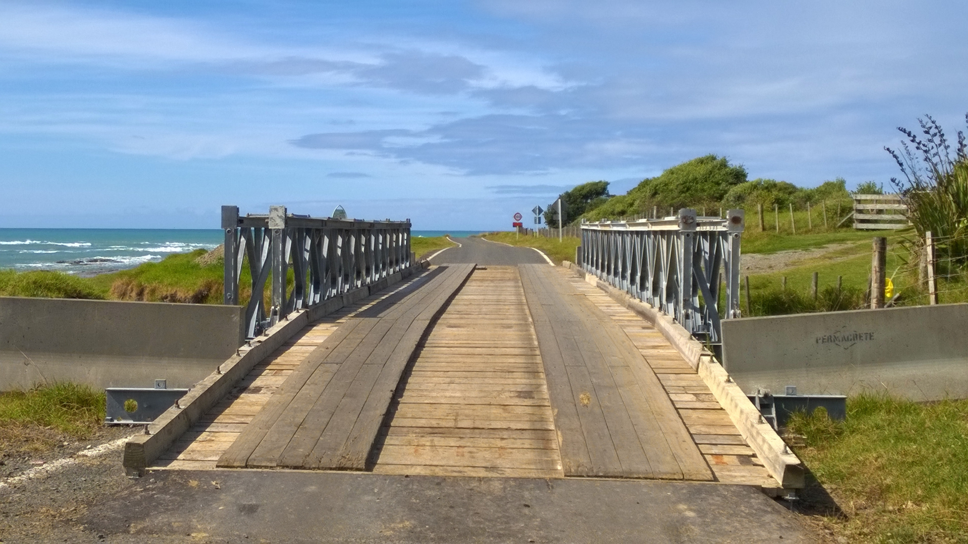
Leaving the lighthouse and descending the stairs to return to the car, we travel along East Cape Lighthouse Road, crossing a low wooden bridge that accommodates water flows from the hills as they make their way out to the ocean.
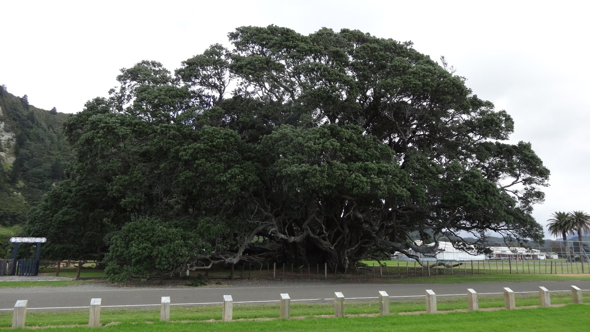
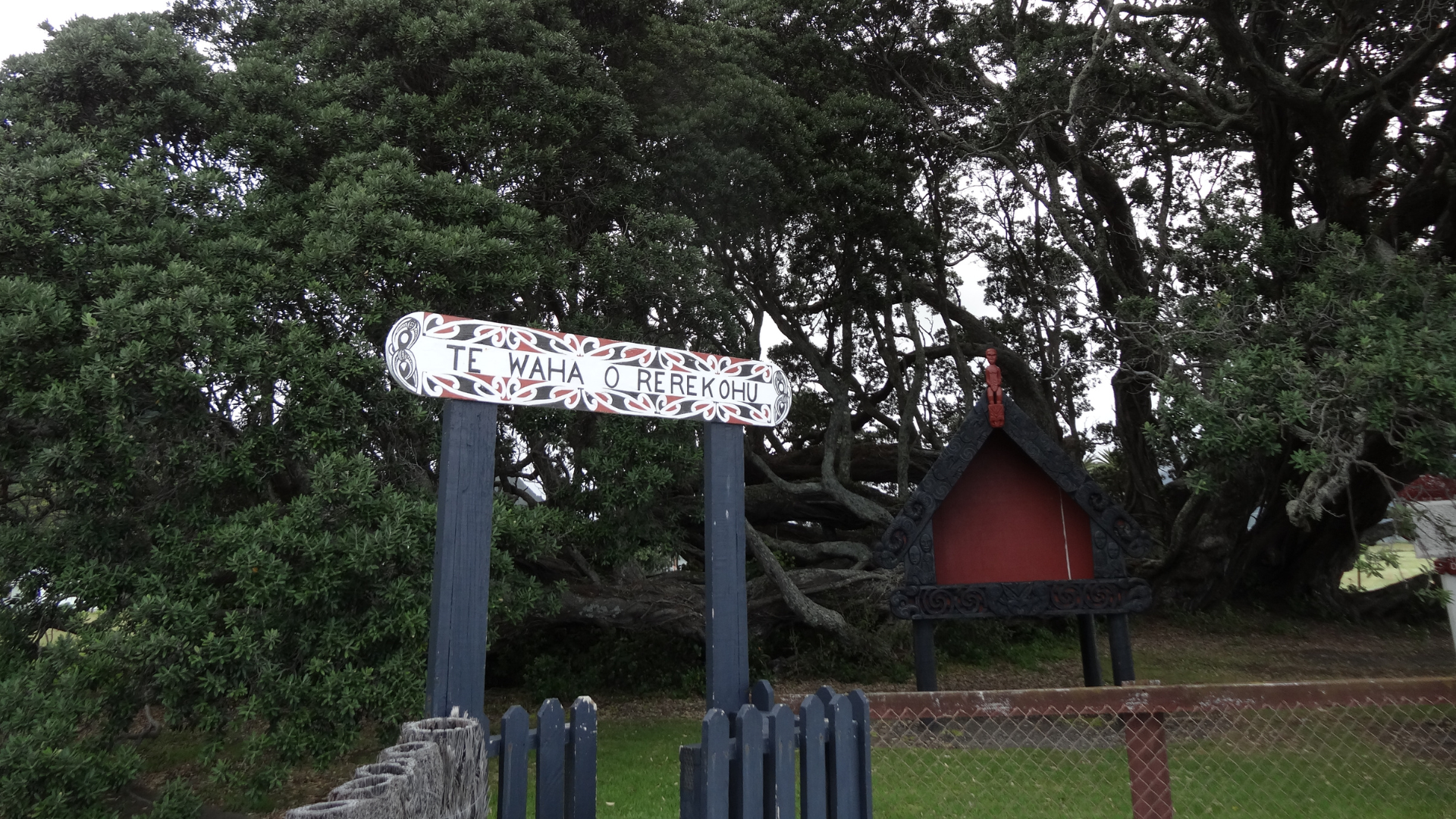
From the lighthouse, it’s roughly 12 kilometres hugging the coastline before arriving at Te Waha o Rerekohu School, which shares its name with the oldest pōhutukawa tree in New Zealand growing in the school grounds. According to the wooden engraved plaque, the tree is well in excess of 350 years old, stands 21.2 metres tall, and measures 40 metres at its widest point, and said to be the largest of its kind in the world.
The tree is so large it was difficult to capture it and its name plaque in one photo, without making the name plaque, near invisible.
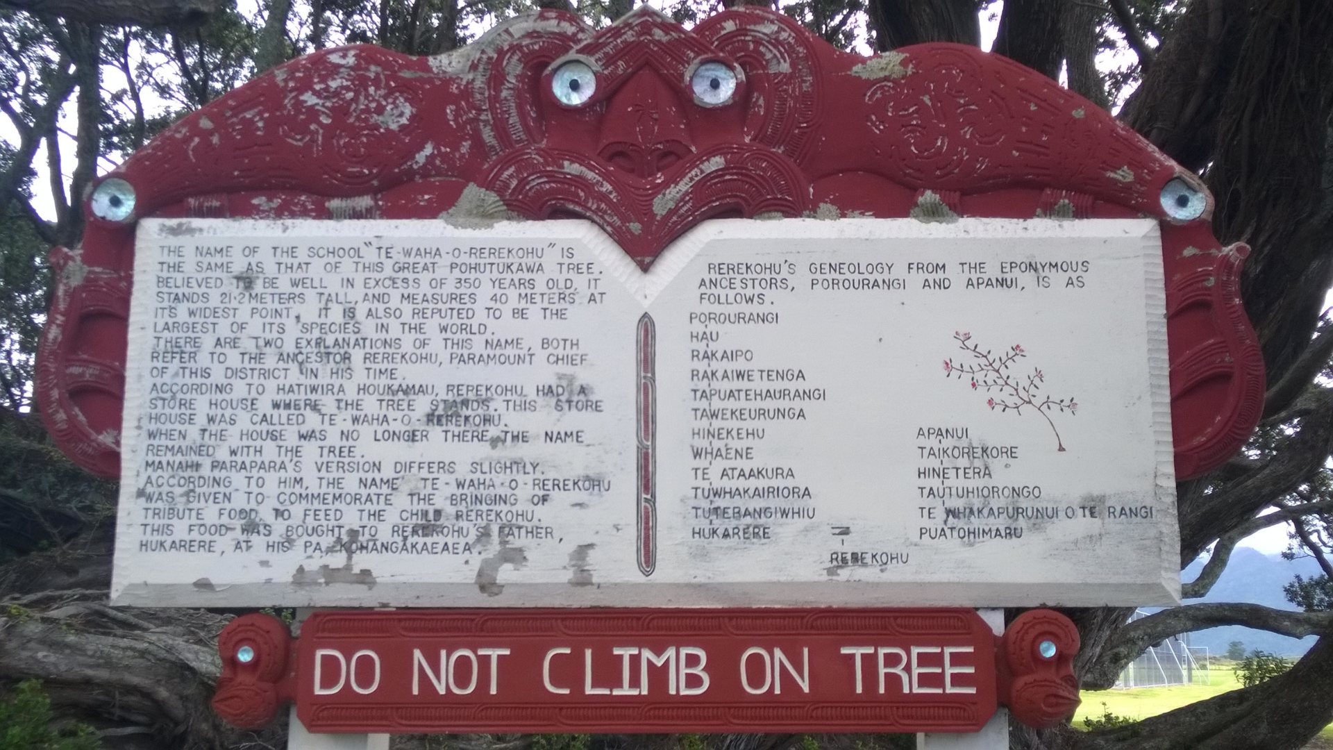
The carved wooden information plaque shares two explanations for the tree’s name, both referring to the ancestor Rerekohu, who was, at the time, paramount chief of the district. According to Hatiwira Houkamau, Rerekohu had a storehouse where the tree now stands, known as Te Waha o Rerekohu, and even after the storehouse was no longer there, the name remained with the tree. The second naming version, shared by Manahi Parapara, differs slightly. According to Manahi, the name Te Waha o Rerekohu was given to commemorate the bringing of tribute food to feed the child Rerekohu. The food was brought to Rerekohu’s father, Hukarere, at his pā, Kohanga‑kaeaea, pā meaning a Māori fortified village or settlement.
Whichever version is held, this magnificent tree continues to stand as a living presence within the landscape, carrying layers of story and memory, and honouring Māori heritage across generations.
By now it’s late afternoon, the light softening as we continue along the coastal road toward Hicks Bay, roughly 40 kilometre drive from the cape, with each bend offering new glimpses of sea and headland.
Hicks Bay, also known by its original name Wharekahika, has been a place of long standing importance for Māori, with its long sweep of sand and naturally sheltered waters offering anchorage, food gathering, and connection to the wider coastal world long before British charts recorded its coastline. The bay sits between Matakaoa Point and Haupara Point and was sighted in 1769 by Lieutenant Zachariah Hicks, an English naval officer aboard Captain James Cook’s Endeavour, the encounter later giving rise to the English name Hicks Bay.
At the western end of the bay stands the old wharf, as a reminder of when coastal shipping was the lifeline for communities up and down the East Coast. Officially opened in 1925, with nearly two thousand people gathering for a large hui (a Māori gathering or assembly) on its opening day, where leaders including Āpirana Ngata named the facility Hinemaurea.
Unlike Tolaga Bay and Tokomaru Bay, which developed as major export wharfs handling goods and livestock for international shipping, Hicks Bay functioned primarily as a local wharf, linking East Coast communities with other North Island ports such as Gisborne, Napier, and Auckland. Coastal steamers called regularly, bringing in essential supplies of sugar, flour, kerosene, and farm equipment, and taking out local produce, including wool, livestock, timber, and maize, for regional trade. Before reliable roads, this wharf was crucial, connecting a relatively isolated settlement to the wider supply chain and sustaining the local economy.
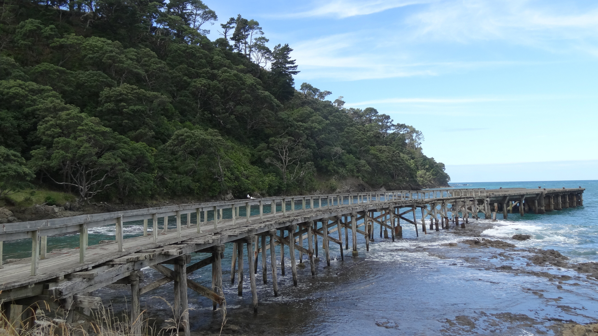
Today, while no longer the centre of trade, the jetty remains a quiet landmark, framed by the bay’s sweeping sands and a favourite perch for local seagulls.
With the planetary energies above, and the Moon drawing me to notice the small, fleeting wonders, the extensive rugged beauty on the Pacific coastline, the textures of the pōhutukawa tree, the detailed and ornate Poa, while Mercury continued to foster connection, helping me engage with the stories of the land, its people, and its history. Uranus added a spark of surprise here and there, opening space to see the unexpected from a new perspective.
Looking back over this section of the journey, from Gisborne to Hicks Bay, the relatively short distance meant my personal planetary placements remained quietly present, and subtly unchanged. Mars Local Space line brought energy and curiosity, pushing me along headlands and coastal tracks, while Saturn kept me grounded, balancing adventure with reflection. The Moon drew me to notice fleeting wonders, the rugged Pacific coastline, the textures of pōhutukawa bark, and the intricate whakairo, while Mercury encouraged connection with the land, its stories, and its people. Uranus added sparks of surprise, inviting fresh perspectives along the way.
Subtle paran lines enriched the experience further, blending practicality with creativity and heightening awareness of my personal alignment with place. From Tokomaru Bay’s headlands to Tikitiki’s carved gateways and the serene stretch of Hicks Bay, this section of the East Cape coast became as much about self-discovery as it was about travel, an unfolding harmony between my planetary energies, the land, and the enduring Pacific Ocean.
Hicks Bay became our overnight stay. Tomorrow, our North Coast road trip continues, heading east and then south along the coastal State Highway 35, enjoying the serene Waihau Bay and stopping for morning tea in Whanarua Bay, before taking time to wander the township of Ōpōtiki and continue exploring the East Cape coast and its stories. The day concludes in Whakatāne, where we rested overnight, a coastal town shaped by the presence of Whakaari / White Island and its long relationship with the Pacific Ocean.
See you soon,
Consider signing up to receive new Soul Travel blogs, travel reflections, and astrocartography insights as new destinations are shared.

✨ If this story resonated with you, you are warmly invited to continue the journey in a way that feels aligned with you.

✨Explore personalised insights through consultations
✨ Begin with ‘The Journey’ Orientation
✨ Listen to Destined Places podcast stories
✨ Save and share Soul Travel inspiration on Pinterest